Posts

Westfield River with Bill
Image
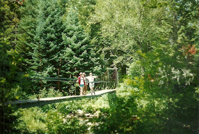
Where: Knightville Dam WMA on East Branch Westfield River When: 9/17/94-9/18/94 With: Bill Bill was itching for a hike, so we decided to hook up and meet halfway for some camping and fishing. We both left at 7AM and arrived within minutes of each other at the Chesterfield Post Office at 9AM. Bill said he'd enjoyed the scenic ride out. We had a brief debate about the need to purchase a fishing license for him, decided not to, and headed down to the water. We parked once again at the parking area just before the gate to the Indian Hollow campground - the only cars there. A man on a mountain bike pedaled out past us just before we went in and headed up the road we'd come in on. After packing up, we pulled on our waders and headed in. A beautiful, warm, partly cloudy day. The river was very low and I was a bit worried as we crossed it. Not the impressive rushing trout stream I'd promised Bill. Once across, we headed up the road, north toward the mini-gorge, and had a ni...

Georgiana Falls, without me!

Image
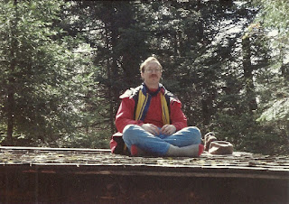
Where: Georgiana Falls, Lincoln NH When: September 17-18, 1994 With: Chip, Dave, Xeth (but not me!) I had a neighborhood picnic to attend, so I couldn't go, but I encouraged the rest of the Stupids to go anyway. I'm pretty sure I suggested the destination - Georgiana Falls, near Lincoln NH. I'd been interested in it myself. The trail followed Harvard Brook up to a series of falls, then just petered out. It seemed like they could enjoy the falls, then get away from the crowds and find a spot to camp in the woods. The only report I recall from the trip was that someone slipped on a rock and dropped/smashed a bottle of booze. I'm reasonably sure this photo was from that trip, at the underpass under 93 (start of the trail).

Westfield River with Chip

Image
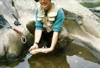
Where: Westfield River, East Branch When: 6/25/94-6/26/94 With: Chip The Westfield River has three branches - West, Middle & East - which flow out of northwest Mass., converge west of Springfield, and then the whole thing dumps into the Connecticut River right at Springfield, which is probably why that city is there. About the same time my brother Bill was asking about this river, Chip called me and said he'd been talking with another lawyer who told him of this great trout stream, which turned out to be the East branch, and a specific spot on the river named The Gorge. We started doing some research and found that this area is home to a couple of state forests, some wildlife management areas, a private nature preserve, and a Corps of Engineers flood control project. Maps in hand, I threw Jane and Andy in the car and we went on a scouting trip a few weeks back. Here's what we found: There's a 7-8 mile stretch of the river running between route 143 in Chesterfield ...

Pillsbury Pond

Image
Where: Pillsbury Lake, Adirondacks When: 4/29/94-5/1/94 With: Bill, Tom This was to be an "ice-out" trip. The intention was to fish a remote pond just after the winter's ice had cleared, when the fish would be especially ravenous for some fresh food. I was up at 5, on the road at 5:30 and at Bill's at 8 after a rainy drive across Massachusetts. We picked up Tom in Delmar (he had just learned of the trip), headed west on the Thruway, then north on 30. The whole time, we passed through occasional rain showers that turned to a downpour just when we decided to stop at rest area, but we managed to avoid being caught outside in the rain. This was significant because Ritz Brothers trips traditionally involve a good soaking. We hoped our luck would change this trip. As we continued north, we started to see patches of snow. Finally, we passed through Speculator and started to look for the access roads. We passed the first because it was too small and rough for my littl...

Lonesome Lake

Image
Where: Cascade Brook Trail, NH When: 1/29/94-1/30/94 With: Chip The previous year's aborted attempt to reach Kinsman Shelter (after I fell through the ice at a stream crossing) virtually ensured that we would try the same route again this year. We were confident that we had learned from our past mistakes and knew what to do to reach our goal. First job - get an early start up the trail and use a shorter route. I got up at 6:30, was on the road at 7, and at Chip's around 8:15. Within a short time we were driving north. We'd planned carefully and had everything we needed, so there would be no stops, not even for alcohol - a first! Everything went fine, until we reached the base of the Basin-Cascades trail (which was 0.3 miles shorter than the previous route we'd taken). The parking lot on the east side of the highway was unplowed. We continued north for quite a ways until finally finding a spot to turn around. We stopped at the west side lot and found it was also sno...

Siamese Ponds

Image
Where: Siamese Ponds, Adirondacks When: 8/14/93-8/15/93 With: Bill, Tom Another Ritz Brothers hike. I was up at 5:30, on the road at 6:00, at Bill's at 8:20, in Delmar to pick up Tom at 9:00, and on the road at 9:30 heading north. We hit the trailhead at 11:00 and found a lot of vehicles parked there. That was a bit of a concern, but it didn't change our mind about the hike. We all did a bit of load lightening, removing stuff from our packs, and then started the hike. The trailhead sign said 5.8 miles to the pond, which seemed reasonable. There was a short uphill to start, then downhill a bit, then a level walk next to river. A recent rain brought out a nice variety of fungi - lobster mushrooms, white coral-like fungus, and others. We also spotted a woodcock along the way. It was a warm, partly cloudy day and the walking was pleasant. Despite all the cars at the trailhead, we didn't run into too many other people on the trail. There was a dayhiker with dog, but th...

Mount Bemis

Image
Where: Mt. Bemis When: June 1992 With: Solo The intent of this trip was to find the now-unmaintained former trail up Mt. Bemis, follow it to the top, bushwhack across to Mt. Nancy, and then descend to the campsite at the outlet of Norcross Pond to spend the night. I drove up under threatening skies, taking the Kancamaugus Highway to Bear Notch Road and then over to the trail head. Just as I arrived at the trailhead, the skies opened up. I packed up in a downpour, using the hatch of my car for cover, and then started walking. This was my third time up this trail, so it wasn't unfamiliar and I quickly settled into an easy pace. A little ways along, I met two women, travelling in the opposite direction. In comparison to my full foul weather gear, they were wearing shorts, gaiters, and raincoats. Probably a better choice of clothes for the warm weather. They mentioned that they were heading out because they hadn't brought a tent, not expecting the rain. We chatted a bit and...