Posts

Showing posts from 1987

Desolation Shelter, Cedar Brook Trail

Image
Where: Desolation Shelter via Cedar Brook Trail When: 8/14/87 With: Solo This was a checkout hike. I wanted to see if this route was skiable, so I decided on a non-snow trip to reconnoiter the path. I followed the same route at the beginning as my previous hike , parking at the switchback on the Kancamagus highway and then taking the Hancock Notch trail in to the Cedar Brook trail. Here's where I started on new trail for me. It was a short, easy climb to the height of land and then I started down. I stopped just inside the forest to take a picture. The sunlight was coming down the trail from the clearing at the height of land, and I lashed my camera to a tree and used the timer to get the shot. As I continued my descent, I heard a noise in the woods to my right. A couple of grouse were chasing me, paralleling my route on the trail. I stopped and they scattered up the hill into the woods. When I started again, they returned to the chase, so I stopped again, and they scattered a...

Mt. Kinsman

Where: Mt. Kinsman When: Summer, 1987 With: Stupid Society Could this be the first full Stupid Society trip? We headed north in Chip's Bombermobile, with the traditional drive off the road just before the parking lot. We went back to a place that all but Dave had been to before. A repeat of my trip of the previous year along Cascade Brook. Chip and Seth had also gone in earlier in the season, on my recommendation. They got rained on. This trip had much better weather and we had a nice hike to the campsite I'd been at before. We even stopped for a dip in the pool, as I had. It took some effort, but Seth finally managed to get a fire going. I think this was the hike I brought the Cuban cigars (brought back from Aruba). Anyway, I remember only bits of things about the camp. Hammocks strung across the stream. Seth sleeping outside on the ground because no one offered him a spot in their tent. The next day, we discovered during breakfast that for once, we'd seriously und...

Hancock-Carrigain Attempt

Where: Hancock - Carrigain When: Summer, 1987 With: Solo The AMC White Mountain Guide says, "The ridge line joining Mt. Carrigain and Mt. Hancock has no trail and is rough bushwhacking." This sounded good to me, so off I went. My plan was to go up Hancock, bushwhack along the ridge, and then drop down to Carrigain Pond for the night. The next day, I'd head up Carrigain and then go back to the car on the Hancock Notch trail. The first part of the trip was exactly as advertised. I hiked in and went up the North Hancock side of the Hancock Loop trail. It was easy at first, then very steep. Fortunately, it wasn't too long and I was soon on top, admiring the view. After a bit, I headed toward the South peak. I was stopped at one point by a grouse in the path, making a big fuss. I looked around and spotted 4-5 chicks nearby. I backed off a bit, let the whole family pass, and then continued on. I was keeping an eye out to the left, looking for a likely spot to pick u...

Old Osseo Trail

Where: Old Osseo Trail When: Summer, 1987 (?) With: Chip I'd enjoyed this hike and convinced Chip to check it out. We headed up Friday night after work and arrived at the Wilderness Trail trailhead in darkness and rain. A Forest ranger came over to check us out and we convinced him we knew where we were going and were properly equipped. We put on the rain gear, grabbed some flashlights and headed in. Before too long, we were at the Osseo trail and in to the campsite, beside the stream. We set up camp and had a nice dinner of fresh mushroomburgers and vodka. A rainfly created a nice dry area, so we were pretty comfy and wound up staying up past midnight. The next day was dry and we went up the trail. Easy at the bottom, tough at the top. Very steep with steps cut into the hill. We made it up though, with Chip carrying a huge amount of water, and found the old trail. We made it to the campsite pretty early and spent the afternoon hanging out and sleeping. Some flies were anno...

XC skiing with Dave & Lia

Image
Where: Wachusett Reservoir, Clinton MA When: 1 April, 1987 With: Dave & Lia An XC ski trip. I vaguely recall that this was not our original destination, but it's where we wound up. I'm not sure if we skied along the reservoir itself or in an adjacent property, but I think I remember seeing a small aircraft flying low along the ice (manned or model...not sure). That would indicate we were along the reservoir. The photos only show woods and snow though...no reservoir. More pictures

Desolation Shelter, Zealand Notch

Image
Where: Desolation Shelter via Zealand Notch When: 2/20/87 With: Chip Buoyed by the success of our last winter hike , we decided to have another go at it. Our plan...drive up to the Zealand Trail trailhead, 3.6 miles in from route 302, then ski through Zealand Notch, pick up the Shoal Pond trail, and follow that down to Stillwater and Desolation. The next day, ski back up and head over to the Ethan Pond shelter for the next night. As always, things didn't quite go the way we planned. To start, the road to the trailhead is closed in the winter. What should've been a 5-10 minute drive wound up being several hours of hard, uphill skiing. By the time we finally reached the trailhead, we were ready to stop right there, but we kept on. As expected, the route from the trailhead in was pretty easy going, and soon we were at the Zealand Falls hut. Or rather, we were at the base of a steep climb up to the hut. We ditched the skis and climbed up. We were greeted by the caretaker an...

Wachusett Mountain XC with Chip

Image
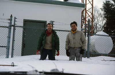
Where: Wachusett Mountain When: 1 February, 1987 With: Chip I have no idea how/why we decided to go here. We must have had a map or some indication of trails in the area. We drove out from Boston, probably along Route 2, and found our way to the backside of Wachusett Mountain, along Westminster Road. We may have parked at the Stage Coach Road trailhead (obvious parking area), or where the Harrington and Dickens trails meet at the road. The latter location is less obvious, especially in the winter, but our photos show us visiting spots along those two trails. Details are very sketchy, but our first route took us uphill and eventually to the wind turbine farm. I remember being on an open slope under the turbines, and it being very windy. From there, we made our way back to and across Westminster Road, and presumably followed the Dickens Trail, because we wound up at a telecommunications facility next to that trail. We scaled the fence and climbed the tower as high as we dared. I remember...